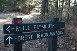
Signs along the roadways in MSSF help visitors find their way around the nearly 12,400 acre forest.
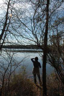
View from the Easthead Reservoir Trail. Trail head begins at MSSF Headquarters' parking lot.

Contact Information for the Friends of Myles Standish State Forest Inc. and the Myles Standish State Forest
Friends of Myles Standish State Forest E-mail: friends@friendsmssf.com
Postal Mail:
John Bescherer, President
Friends of Myles Standish State Forest, Inc.
P.O. Box 302
Carver, MA 02330Visit the Friends of Myles Standish State Forest Meetup Group to find out about our upcoming hikes, birding events and other activities.
Check out the unofficial Myles Standish State Forest page on Facebook.
Contact the Myles Standish State Forest Headquarters:
Myles Standish State Forest
John C. Roberts
Recreational Facility Sup. IV.
P.O. Box 66
South Carver, MA 02366
PH 508-866-2526
Fax 508-866-5043
Email: john.roberts@state.ma.usMyles Standish State Forest Official Links
Myles Standish State Forest is located in the County of Plymouth, Massachusetts, within the towns of Plymouth, Carver and Wareham.
Visit the Department of Conservation and Recreation (DCR) official web site for MSSF's official web site by clicking here.
FMSSF meetings are held on the first Wednesday of the month in the Conference Building,across the street from the forest headquarters. Check our Meetup Home Page for the next meeting date and time. The Conference Building is wheelchair accessible. All are welcome.
Directions to Myles Standish State Forest:
Myles Standish State Forest is located in southeast Massachusetts bordering the towns of Plymouth, Carver, and Wareham.
From the North: Take Rte. 3 south to exit 5, turn right onto Long Pond Rd. (west) and continue for about 3 miles to the entrance at Alden Road on the right.
From Rte. 495: Take Rte. 495 to exit 2 (South Carver) and the intersection with Rte. 58. Take Rte. 58 2.6 miles north When 58 forks left, continue straight on Tremont St for another 0.8 miles until you reach Cranberry Rd. on your right. Follow Cranberry Road 1.4 miles into park to reach park headquarters. Follow the signs to other locations in the park like the College Pond swimming area or the Curlew Pond campground(about 4 miles), Charge Pond or Fearing Pond (about 3 miles).
From Southeast: Rte.3 north to exit #3. Turn west off of ramp. (Left if you came from south of the exit) After 0.4 miles, take a right onto Long Pond Rd, go 2 miles to forest entrance. Follow signs through park to headquarters (about 6 miles) or other locations like College Pond, Charge Pond or Fearing Pond. Camp Squanto and Camp Cachalot are located near Fearing Pond.
Join Friends of Myles Standish State Forest and help promote pine barrens region wide. Download and mail the Membership Form or use the Paypal button below to join online. Thank you!